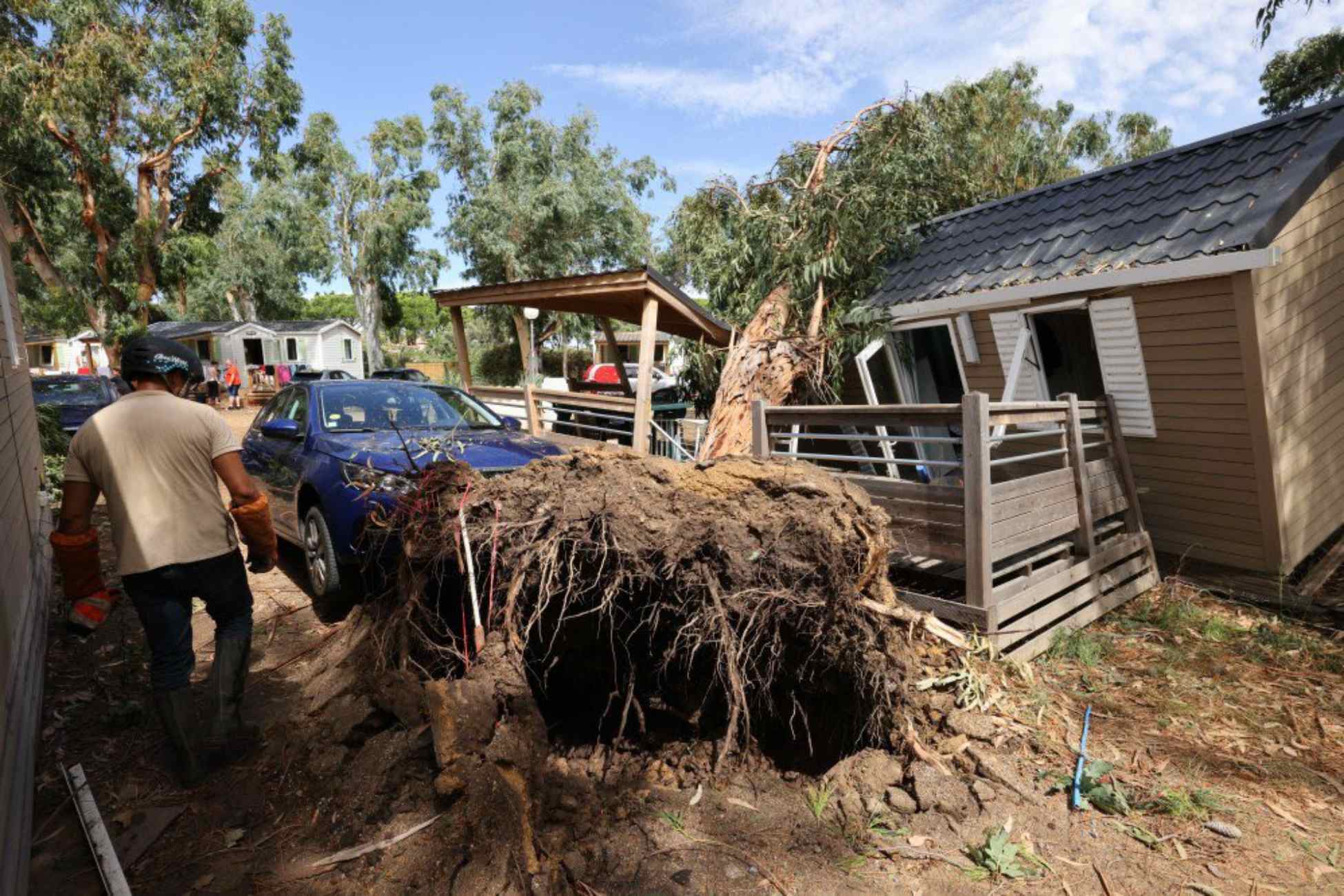
On August 18th, a violent weather phenomenon known as a derecho crossed six European countries and left 14 people dead. A long chain of severe thunder storms and high winds with which North Americans may be familiar but which Europeans - and especially those living in Southern Europe - have practically never heard of. This one, however, swept across the northern rim of the Mediterranean and into Central Europe, causing death and destruction as it went.
"Derecho" is the Spanish word for "straight ahead" and it is often contrasted with the violenting rotating winds of another violent North American weather feature, also with a Spanish-language name, the tornado. But last Thursday, the phenomenon struck the European continent, which has been sweltering under one of the hottest summers on record. A derecho is defined as a series of intense wind storms, blowing at speeds over 90 km/h for almost their entire route with an extension of at least 400 km. Unlike ordinary thunderstorms, these phenomena occur in a connected series, sweeping across vast distances quickly and also bringing heavy downpours.
V Kranju je odneslo vsaj eno streho. :( pic.twitter.com/B2Z1YSqyL0
— Matej Artač (@matej_artac) August 18, 2022
Translation from Slovenian:
"At least one roof was blown off in Kranj"- Matej Artač
The first storms broke over the city of Barcelona on the shore of the western Mediterranean on the night of August 17th, and then moved out to sea in the direction of the Balearic Islands. The convective system then travelled more than 1600km, brutally crossing six countries: Spain, France, Italy, Austria, Slovenia and the Czech Republic, with more than 200,000 lightning strikes recorded. It was one of the most long-lasting phenomena of such violence in the recent meteorological history of Europe.
Selon un bilan encore provisoire, 12 personnes furent tuées et au moins 70 blessées par ce système orageux qui a pris naissance vers #Barcelone dans la nuit du 17 au 18 août 2022 et qui a parcouru plus de 800 km, impactant au total 6 pays 🇪🇸🇫🇷🇮🇹🇸🇮🇦🇹🇨🇿 à des degrés assez divers. pic.twitter.com/KU9jjH05l1
— Nahel.B (@WxNB_) August 19, 2022
French online meteorologist Nahel B. mapped this weather event in his tweet, while also defining what a derecho is: "A zone of convective winds extending over an area whose major axis exceeds 400 km, at least 100 km wide," with a "clearly identifiable spatio-temporal progression".
A total of 14 deaths were recorded along the route, including those of several children, with 75 people recorded as injured. One of the places worst affected by the phenomenon was the island of Corsica, where wind gusts reached 224 km/h, specifically in the western coastal area of Marignana.
Impresionante la brutalidad de las tormentas que azotaron ayer a Córcega y la Riviera italiana.
— J. J. González Alemán (@glezjuanje) August 19, 2022
Es muy probable que hayan estado asociadas a un "derecho", fenómeno muy peligroso y raro en Europa.
Condiciones propias de un huracán de categoría 3.😳pic.twitter.com/SUPqBIz808
Spanish weather service professional and researcher in atmospheric dynamics Juan Jesús González Alemán noted the "brutality of the storms that hit Corsica and the Italian Riviera". "It is very likely that these were associated with a 'derecho', a very dangerous and rare phenomenon in Europe." The conditions were equivalent to those of a category 3 hurricane, said González.
The event also affected other parts of Italy, such as this street in Venice:
Strada nuova, Venezia.
— Cris 🇺🇦🇪🇺 (@Cris_quella) August 18, 2022
18 agosto. pic.twitter.com/h1dlhIjQmW
The question of whether this summer's anomalously high temperatures in Europe were behind the intensity of the event will have to be studied. According to González Alemán, "to study the relationship of this strange and extreme event with climate change, an in-depth analysis is necessary, but everything points to the high temperatures of this summer in the Mediterranean Sea as factors which may have encouraged the intensity of this phenomenon". This August, the waters of the Mediterranean reached temperatures of 29°C, more than 3°C above its climatic average for the month.
Y es posible (a falta de investigarlo) que sea el primer evento meteorológico extremo del "otoño" en el Mediterráneo que haya sido extremado por las altas temperaturas del mar este verano.
— J. J. González Alemán (@glezjuanje) August 19, 2022
Las temperaturas en la zona eran más de unos 28-29ºC, más 3ºC superior a lo normal! pic.twitter.com/XpGMjTGWvg

